Nepal Is the Warning. Alaska Is Already Living the Experiment.
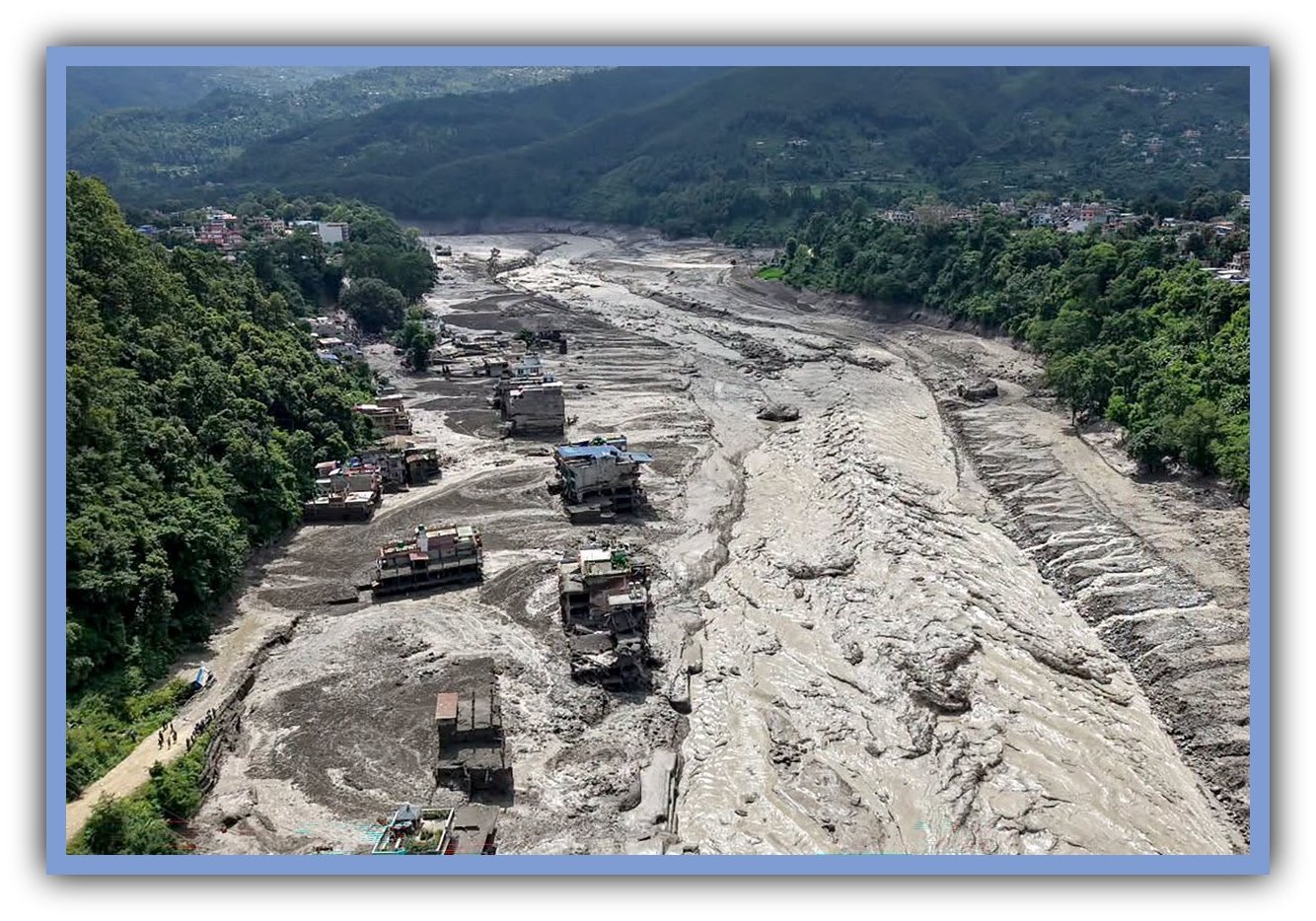
Floodwaters surge through Nepal’s Himalayas after a glacier-related collapse sent ice, rock and debris downstream on August 26, 2026. The disaster devastated communities and infrastructure along the Bhotekoshi and Trishuli river systems. Photo: Prabin Ranabhat/AFP via Al Jazeera.
A devastating glacier-related disaster in Nepal is putting a growing global problem back in the spotlight: What happens to communities when a warming climate changes the glaciers and mountain landscapes above them?
For Alaska, that isn’t a hypothetical question.
The state is home to thousands of glaciers, and scientists have been documenting significant changes in many of them for decades. Some are retreating. Some are thinning. Some are losing mass year after year. And in places such as Juneau, changes in the glacier system are already creating recurring flood risks for people living downstream.
Nepal and Alaska are not experiencing the same thing. The August 26 disaster in Nepal involved a catastrophic mountain collapse that sent ice, rock and water down a valley. Alaska’s glacier-related hazards take different forms.
But the connection is worth understanding.
A warming climate is changing frozen landscapes, and those changes can have consequences far beyond the ice.
Nepal’s Disaster Wasn’t Just About Melting Ice
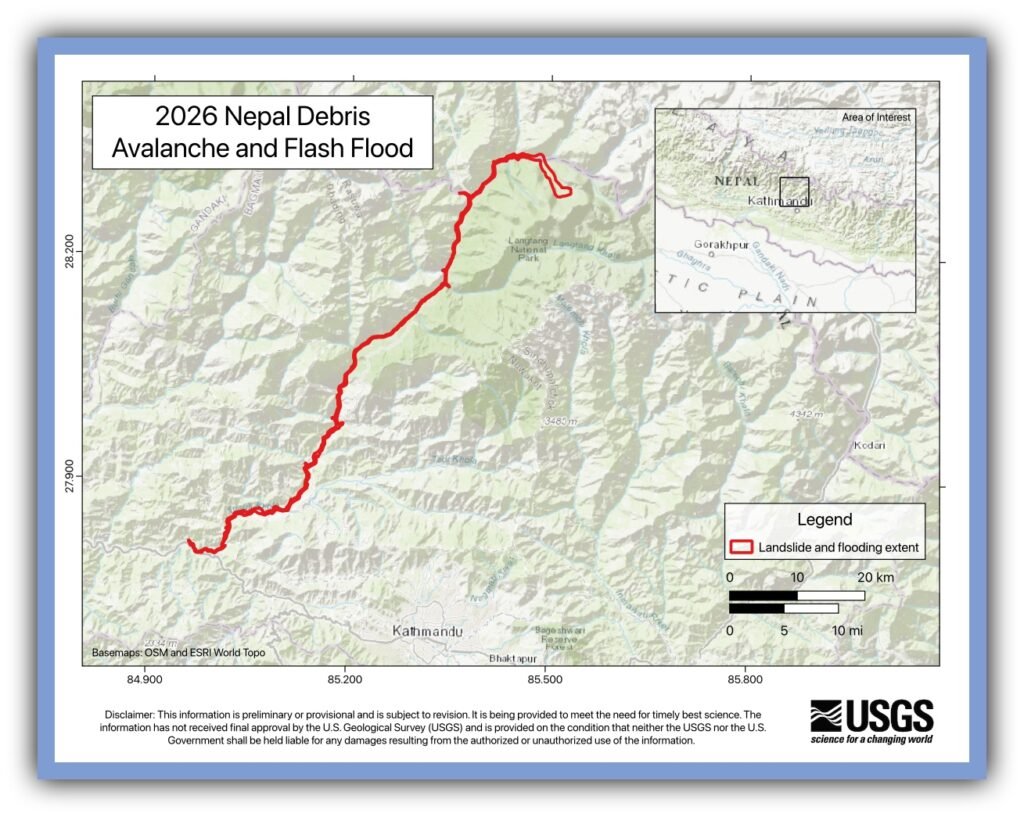
On August 26, a catastrophic collapse in Nepal’s Himalayas sent ice, rock and water racing down a mountain valley. The resulting debris flow traveled about 62 miles downstream, destroying infrastructure and cutting off communities. More than 1,000 people have died, with thousands still missing.
Scientists are still working out exactly what triggered the collapse and how much climate change contributed. That’s an important distinction. It would be wrong to simply say, “Climate change caused the disaster.”
But there is no question that the high-mountain environment is changing. Glaciers are shrinking, permafrost is thawing in some areas, and lakes are growing where glaciers retreat. Those changes can affect the stability of mountain slopes and the way water moves through valleys. For people living below those mountains, what happens up there can eventually become their problem down here.
Alaska Doesn’t Have to Imagine What Glacier Change Looks Like
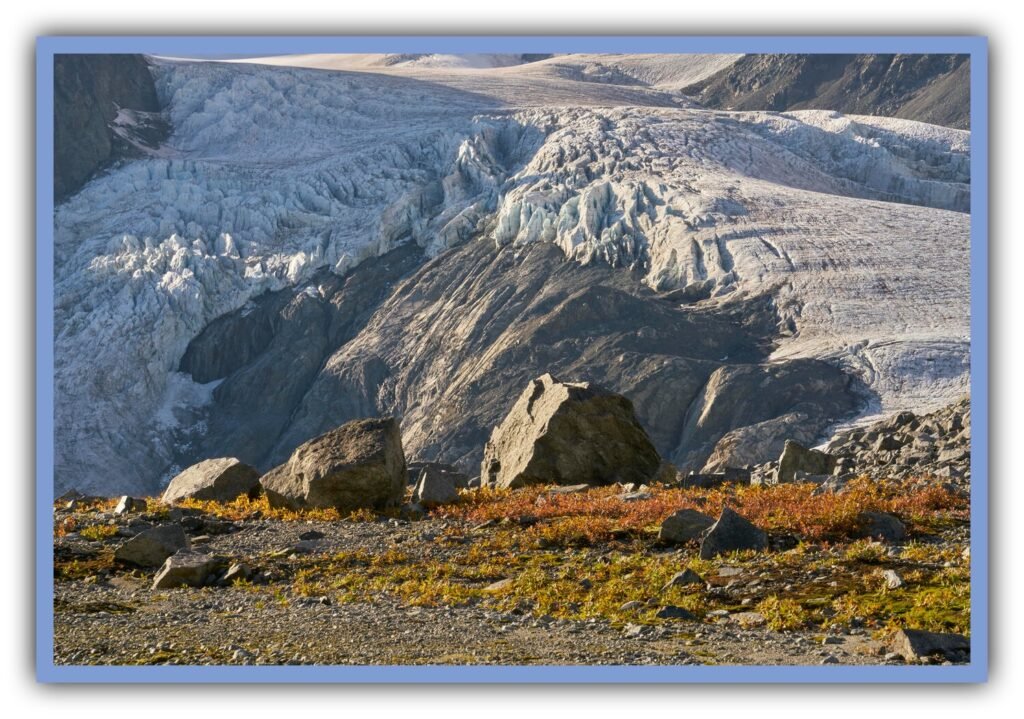
Alaska has thousands of glaciers, and scientists have been measuring some of them for decades. Those long-term measurements tell us much more than a before-and-after photograph ever could.
Gulkana Glacier in the eastern Alaska Range has lost mass for 17 consecutive years. Lemon Creek Glacier on the Juneau Icefield has lost mass for 13 consecutive years. Those aren’t predictions or computer models. They’re measurements of how much mass the glaciers gained and lost over time.
That doesn’t mean every Alaska glacier loses ice every single year. Wolverine Glacier on the Kenai Peninsula actually gained mass in 2025 after years of losses. A particularly snowy or cool year can give a glacier a temporary boost. The important thing is the longer-term trend.
Mendenhall Shows What Happens When Glacier Change Reaches the Neighborhood
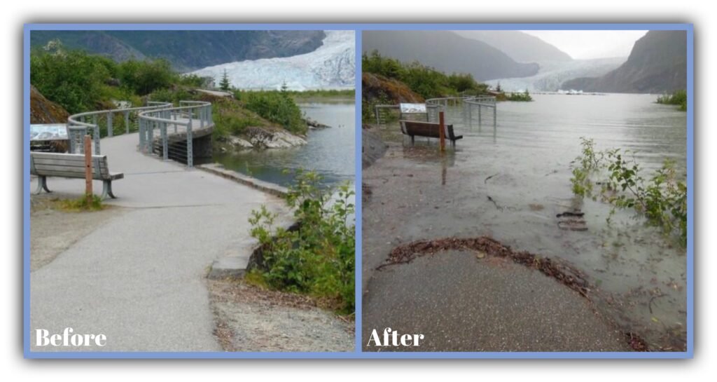
For people in Juneau, glacier change isn’t an abstract conversation about satellite images. It’s something they have to prepare for.
Suicide Basin, beside the Mendenhall Glacier, fills with water during the summer. Eventually, that water drains beneath the glacier and flows into Mendenhall Lake and the Mendenhall River, producing what scientists call a glacial lake outburst flood.
It’s been happening since 2011, and it happened again this summer.
On August 13, 2026, the Mendenhall River rose to about 14.7 feet, making it the fourth-highest flood on record. The record was set just one year earlier, when the river reached about 16.6 feet.
The floods aren’t getting bigger every year, and that’s an important point. Weather, snow, the amount of water stored in Suicide Basin and the changing shape of the glacier all influence the size of an individual event.
What is remarkable is that Juneau now expects the possibility of a glacier-fed flood every summer. A hazard that was once unusual has become something the community monitors, plans for and prepares to respond to.
Taku Glacier Changed Its Mind
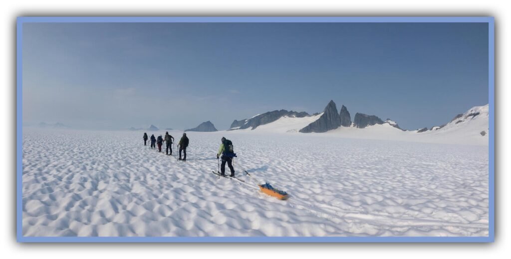
Taku Glacier offers another reminder that glaciers don’t always behave the way we expect.
For about a century, Taku was advancing while many other glaciers were retreating. Then its trajectory changed. Its long period of advance ended as its mass balance deteriorated, and the glacier began retreating in 2015.
That’s why scientists are careful about making sweeping statements about individual glaciers. Temperature isn’t the only thing that matters. Snowfall, ice flow, calving and the shape of a glacier all affect what happens.
But when the climate changes, glaciers are operating under different conditions. Over time, those conditions can shift the balance between gaining ice and losing it.
Columbia Glacier Has Retreated More Than 16 Miles
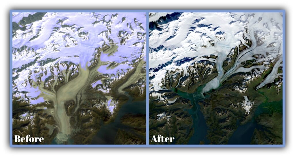
Near Valdez, Columbia Glacier gives us a much more dramatic picture of long-term change.
Since 1980, its main branch has retreated more than 26 kilometers, or about 16 miles, according to the U.S. Geological Survey.
Climate fluctuations helped set Columbia’s retreat in motion, but the glacier’s own calving and movement have also influenced how quickly it has pulled back. That distinction is important because glacier behavior isn’t controlled by temperature alone.
The bigger point is that a changing climate can push a glacier into a new phase, after which the glacier’s own dynamics can determine how that change unfolds.
Alsek Shows What Happens When the Ice Moves Out
Alsek Glacier offers another glimpse of what a changing landscape can look like.
NASA’s 2026 satellite analysis follows the glacier from 1985 through 2025. The imagery shows the glacier retreating and thinning while a lake at its terminus has expanded.
That illustrates something easy to overlook when we talk about melting glaciers. When the ice retreats, the landscape doesn’t simply remain empty. Water can occupy newly exposed areas, rivers can change, and ecosystems can respond to the new conditions.
In other words, glacier retreat isn’t just about losing ice. It can mean changing the landscape itself.
This Isn’t About Saying Alaska Is the Next Nepal
It isn’t.
The Nepal disaster and the Mendenhall floods are different events with different physical mechanisms. Nepal experienced a catastrophic mountain collapse involving ice and rock. Juneau experiences recurring floods caused by water draining from Suicide Basin beneath the Mendenhall Glacier.
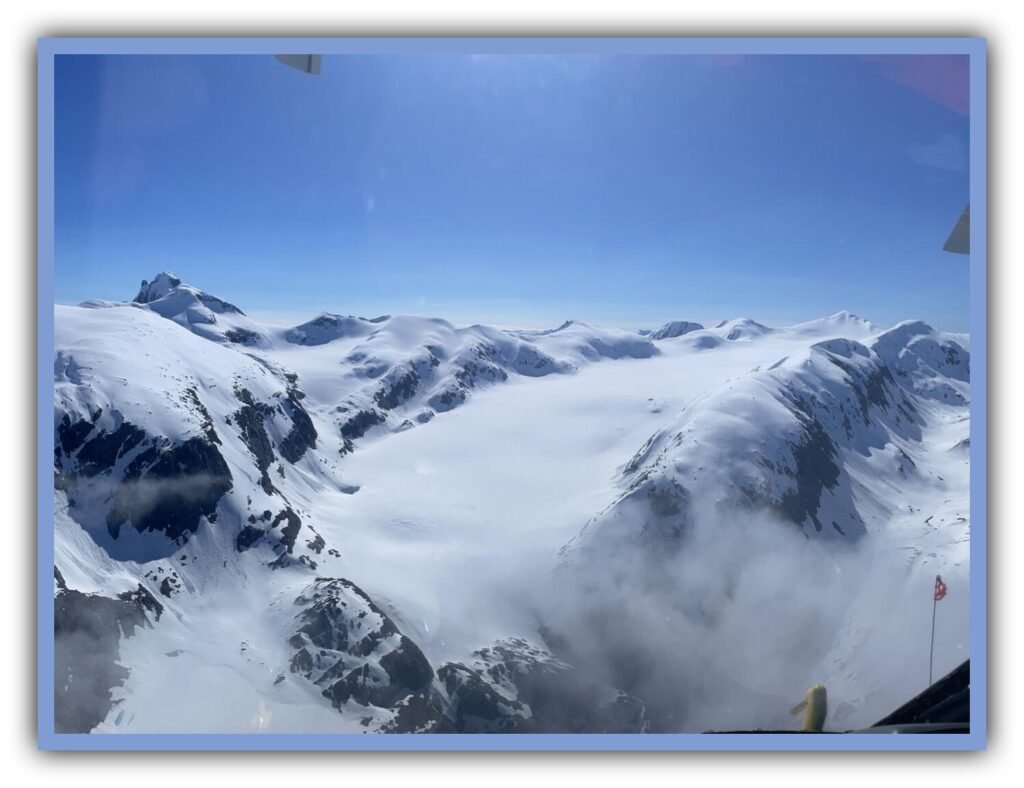
Gulkana and Lemon Creek are examples of long-term mass loss. Taku changed from advancing to retreating. Columbia has retreated more than 16 miles. Alsek is retreating while a lake expands at its terminus.
These are different glaciers and different processes, but together they tell us something important about Alaska’s changing frozen landscape.
Alaska Is Already Living the Experiment
Glaciers aren’t simply scenery. They store enormous amounts of freshwater, shape the valleys and mountains around them, feed rivers and influence the ecosystems and fisheries those rivers support. As glaciers change, the effects can extend well beyond the ice itself, reaching communities, infrastructure and the water systems that Alaskans depend on.
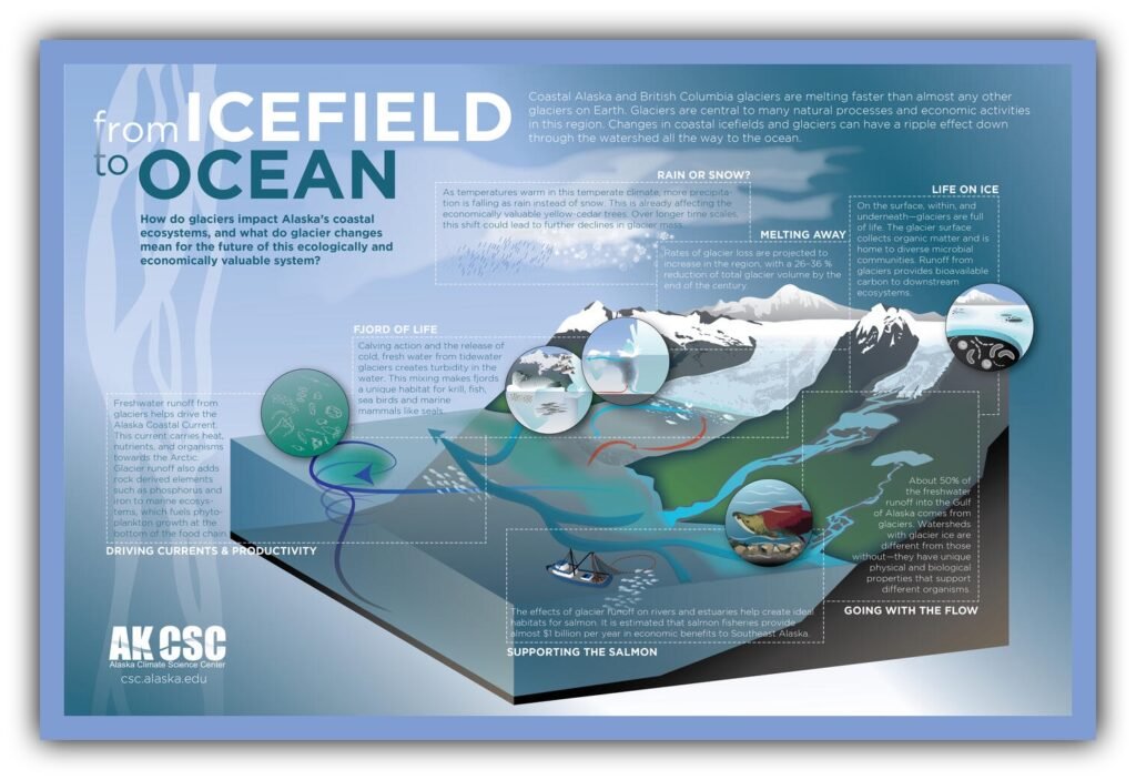
The connections don’t stop at the glacier’s edge. Glacier runoff can influence marine habitats, ocean currents and economic activities along Alaska’s coast. The From Icefield to Ocean Poster, developed through Alaska Climate Science Center research and workshops, was created specifically to help Alaskans understand those connections.
That’s why the tragedy in Nepal matters to Alaska. It doesn’t mean Juneau is about to experience the same disaster, and it doesn’t mean every Alaska glacier is destined to disappear. It means we should pay attention to what happens when a warming planet changes the physical landscape.
Alaska has already been collecting the evidence for decades. We can see it in Gulkana’s 17 consecutive years of mass loss, Lemon Creek’s 13 years, Mendenhall’s recurring floods, Taku’s reversal after a century of advance, Columbia’s more than 16 miles of retreat and Alsek’s expanding lake.
We don’t need to wait for some future catastrophe to prove that Alaska’s glaciers are changing.
They’re already telling us.
The question now isn’t whether the ice is changing.
It’s what Alaska does next.
What do you feel about this post?

Like

Love

Happy

Haha

Sad