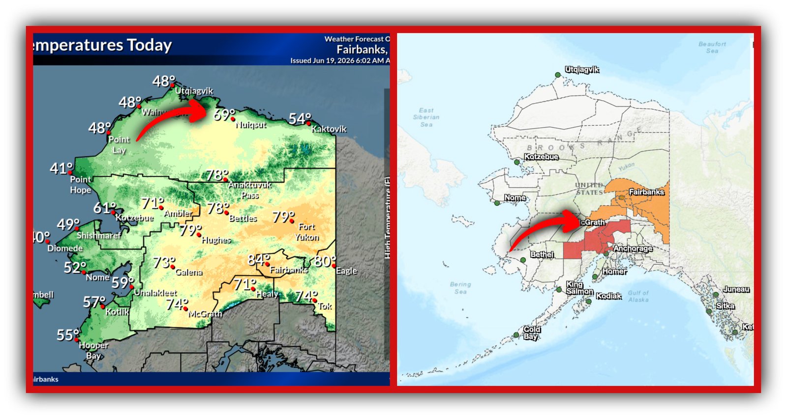
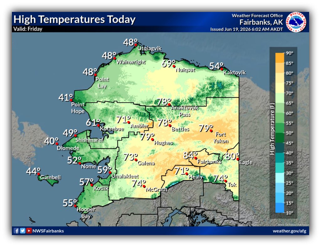
Side-by-side National Weather Service maps show North Slope temperatures near 70°F and Red Flag Warnings across Southcentral Alaska, consistent with a warming climate and more frequent high-impact summer weather conditions.
Thunderstorm-driven fire risk in the south as the North Slope warms into the upper 60s.
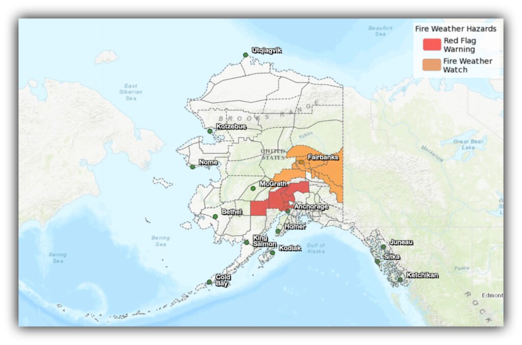
By Gina Hill | Alaska Headline Living | June 19, 2026
A Red Flag Warning is active in Southcentral Alaska until 1 a.m. Saturday AKDT, while the North Slope runs unusually warm near 69°F.
A combination that highlights how sharply Alaska’s summer conditions are shifting across regions.
This is not just “different weather in different places.” It is a snapshot of a broader pattern: Fire weather risk in the south and unusually warm Arctic conditions in the north happening under the same atmospheric setup.
Southcentral is under active fire weather conditions across the Mat-Su Valley, Parks Highway corridor, Denali Highway region, and parts of the Susitna Valley. Thunderstorms are expected during the afternoon, bringing lightning into areas where fuels are dry enough to ignite quickly.
Rain will be uneven. Some areas may see brief wetting, while others see mostly lightning and gusty, shifting winds near storm cells. In Alaska terrain, that combination is enough to start multiple fires in a short window.
At the same time, Nuiqsut, Alaska is pushing into upper-range summer warmth near 69°F. For the North Slope, that is uncommon but not unheard of, and it reflects how easily warm air is reaching farther north during recent summer patterns.
What stands out is not any single number or warning on its own, but the timing. One part of Alaska is dealing with lightning-driven fire risk under a Red Flag Warning, while another is seeing unusual Arctic warmth in the same system window.