




The Crowded Sky Problem
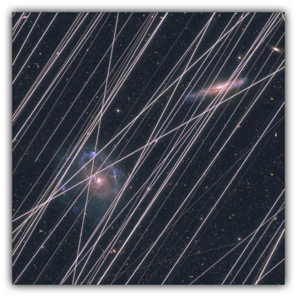
Satellite swarms are expected to photobomb more than 95 percent of images from some space telescopes, potentially contaminating views of the cosmos across multiple orbiting observatories. Credit: Jenna Ahart | Nature.com
New SPHEREx findings from NASA show satellite trails are now a regular contaminant in space data, with no global rules to manage the problem.
Gina Hill | Alaska Headline Living | May 29, 2026
For most people, the night sky still feels like something steady and untouched. You look up, you expect stars. What you probably do not expect is traffic.
But astronomers are now working in a very different reality.
A new arXiv preprint (arXiv:2605.27501) using NASA’s SPHEREx space telescope suggests that satellites in low Earth orbit are showing up in astronomical images so often that they are becoming a routine source of contamination in scientific data.
This is no longer about the occasional streak. It is now routinely captured in exposures.
The Orion Nebula, With Something Extra
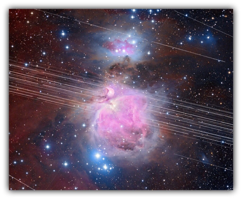
Credit: A. H. Abolfath, NOIRLab, NSF, AURA.
What should be a clean view of deep space is interrupted by bright, straight lines. Those lines are satellites moving through the telescope’s field of view during the exposure.
It is a simple visual, but it reflects a much larger shift in how space science now works.
What SPHEREx Is Actually Seeing
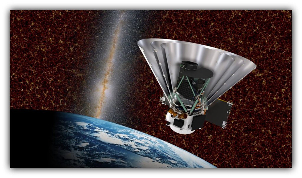
SPHEREx is designed to map the entire sky in infrared light. It is not taking pictures for aesthetics. It is measuring extremely faint signals from galaxies and cosmic structure to understand how the universe evolved.
That requires extremely clean, consistent data.
But between May and September 2025, researchers found something difficult to ignore. About 73 percent of SPHEREx images contained at least one satellite trail. On average, each exposure had a little more than two streaks.
These are not random artifacts. The trails line up with known orbital paths, meaning they reflect real objects moving through low Earth orbit.
The Sky Now Has Traffic Patterns
These streaks are no longer rare. They are showing up again and again in wide-field surveys and space telescope images as low Earth orbit fills with active satellites.
A satellite only takes seconds to cross a telescope’s view. But the camera may be collecting light for minutes at a time. That timing mismatch turns a fast-moving object into a long, bright line stretched across the final image.
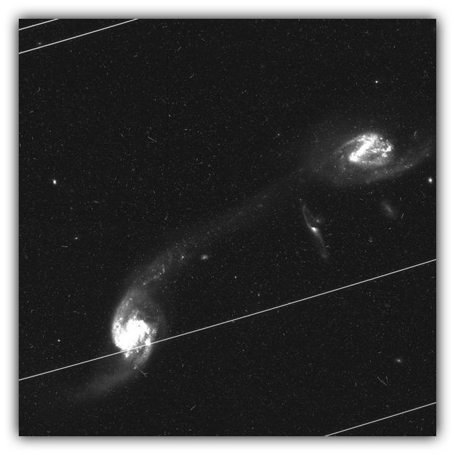
Credit: NASA, Hubble Asteroid Hunter Team, University of Leicester.
Each line is a satellite passing through during the exposure. It is not part of the scene the telescope is trying to measure. It is something moving through the data while it is being collected.
By the time the exposure is finished, the image is no longer just the sky. It is the sky with a human-made trace drawn through it.
Why This Becomes A Scientific Problem
When a satellite crosses a telescope’s view, it does not just leave a visible mark. It overwhelms the pixels along its path. Those pixels stop being usable for measurement.
Astronomers either mask them out or attempt to reconstruct what should have been there. That becomes manageable in isolation, but it scales into a major issue when it happens across thousands of images.
Modern astronomy is statistical. It depends on measuring millions of galaxies and looking for patterns across them. If parts of that data are missing or altered, even slightly, it can affect results in subtle but important ways.
This is why scientists use the term “contamination.” It refers to data that is no longer fully reliable, even if the image still looks usable at a glance.
Who Is Responsible For This Situation
There is no single authority controlling how many satellites can occupy low Earth orbit.
Instead, space is governed by international agreements that assign responsibility to individual countries for the satellites they launch. That system worked when space was relatively empty.
It does not scale well to the current environment.
There is no global limit on how many satellites can be deployed. There is also no central system that coordinates orbital traffic in real time or sets binding rules based on scientific impact.
In practice, that means:
- Satellites are approved at the national level
- There is no shared global cap on orbital density
- Coordination with astronomy is largely voluntary
So each satellite gets approved one at a time, but no one is really managing what happens when all of them are up there together.
Why That Gap Matters
Each satellite serves a purpose. Internet access, communications, Earth monitoring. On its own, each launch is rational and useful.
But the combined effect changes the environment for everyone using the sky, especially science.
Astronomy is uniquely sensitive because it depends on long, uninterrupted observations of extremely faint signals. It is one of the few fields where human infrastructure directly shows up as noise in the raw data.
Right now, there is no global mechanism that defines when low Earth orbit becomes too crowded for high-precision science.
That absence is the core issue.
What Can Be Done And What Is Missing
There are partial solutions.
Satellites can be made less reflective. Operators can share precise orbital data so streaks can be predicted. Telescopes can adjust observing schedules or use software to remove contaminated pixels.
These steps help, but they do not eliminate the problem. They mostly manage the aftermath.
What is missing is upstream coordination. A shared system that sets limits on orbital density and manages it as a collective resource, not just a series of individual approvals.
Without that, the burden shifts to astronomers cleaning increasingly contaminated data after the fact.
Beyond Astronomy
This is not just a scientific inconvenience.
The same satellite networks creating streaks in telescope images are also part of everyday life on the ground. They carry internet, phone service, navigation signals, and television to places where ground infrastructure is limited or impossible to build.
Think about a simple moment like driving through a rural stretch of road with no cell towers nearby. Your map still loads, your music still streams, and your phone still connects. Or a home far from any city where satellite internet is the only way to get online at all. That connection often depends on satellites in low Earth orbit quietly relaying signals across long distances.
That is the tradeoff sitting underneath this entire issue.
These systems are useful, sometimes essential. But they also add to the growing number of objects moving through the same region of space that astronomers depend on for clean observations.
Astronomy tends to notice these changes first because it depends on an undisturbed view of the sky. SPHEREx is showing that this assumption is no longer valid. Satellite trails are no longer rare interruptions. They are now a regular feature that has to be accounted for in the data itself.
The sky is still there. But, it is no longer clean.
What do you feel about this post?

Like

Love

Happy

Haha

Sad