

💅 Memaw’s Arctic Roll: Fog, Snow & Saturday Surprises
🚗💨 Saturday, November 14, 2026
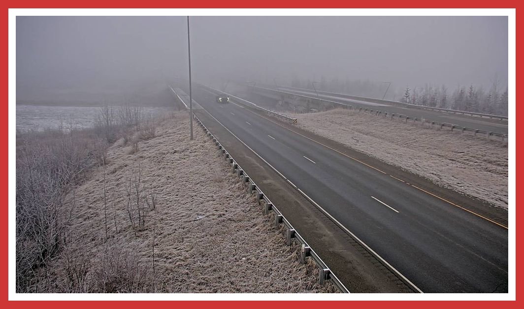
☕️ Alaska, we have a visibility problem this morning, and snow is waiting in the wings. The National Weather Service has extended the Dense Fog Advisory until 11 a.m. for Anchorage, the Mat-Su and Susitna valleys. Wasilla Airport was reporting freezing fog and visibility of just one-quarter mile at 9:56 a.m. Talkeetna, by comparison, was reporting 10 miles of visibility.
The next concern is tonight and Sunday. Snow is expected to spread across Southcentral, with winter weather advisories covering several commuter corridors. Seward also has strong winds in the forecast. Keep those headlights on, slow down, leave extra room, and don’t assume the road around the next bend looks like the one behind you.
🚦 The Daily Verdict
- Roads: Use extra cautionDense fog is creating hazardous visibility in the Anchorage and Mat-Su areas this morning. Snow arrives tonight in several locations, with mixed precipitation and possible icing becoming concerns Sunday night into Monday.
- Traffic: Fog can make it difficult to see stopped or slowing vehicles. No active statewide alerts are listed by Alaska 511, but that does not mean every road is clear of incidents or trouble.
- Sky: Mostly cloudy across much of Southcentral. Snow is expected to develop tonight or early Sunday, depending on location.
- Headlights: ON! Fog and reduced visibility are the immediate concerns. Use low beams in dense fog, slow down, and leave plenty of following distance. Keep lights on whenever weather reduces visibility.
🚨 Mat-Su Watch
The Dense Fog Advisory now runs until 11 a.m. for the Lower Matanuska Valley and Susitna Valley. At 9:56 a.m., Wasilla Airport reported freezing fog, 19°F and visibility of just one-quarter mile. Talkeetna Airport reported 7°F but 10 miles of visibility at 9:53 a.m.
That difference is a good reminder: conditions can change dramatically over a short distance. Fog developed around Knik Arm and along portions of the Glenn and Parks highways. The NWS warns that dense fog may linger across the Anchorage Bowl and Mat-Su valleys through midmorning.
Tonight, snow is forecast after 9 p.m. around Wasilla, with less than half an inch possible. Talkeetna is forecast to see snow mainly after midnight, also with less than half an inch possible.
🚨 Southcentral Watch: Anchorage, Hillside & Eagle River
A Winter Weather Advisory is in effect from 10 p.m. Saturday through 10 p.m. Sunday for Anchorage and Eagle River, including the Hillside.
The National Weather Service forecasts 3 to 9 inches of snow, with the highest totals expected in South Anchorage and the Hillside. Areas near Chugiak are expected to receive less. Travel could become very difficult.
Snow is expected to begin late tonight and continue through Sunday. By late Sunday evening, warmer air moving in above the surface could change conditions to a mix of snow and freezing rain, creating a risk of a light glaze of ice.

🏙️ Anchorage City Commute
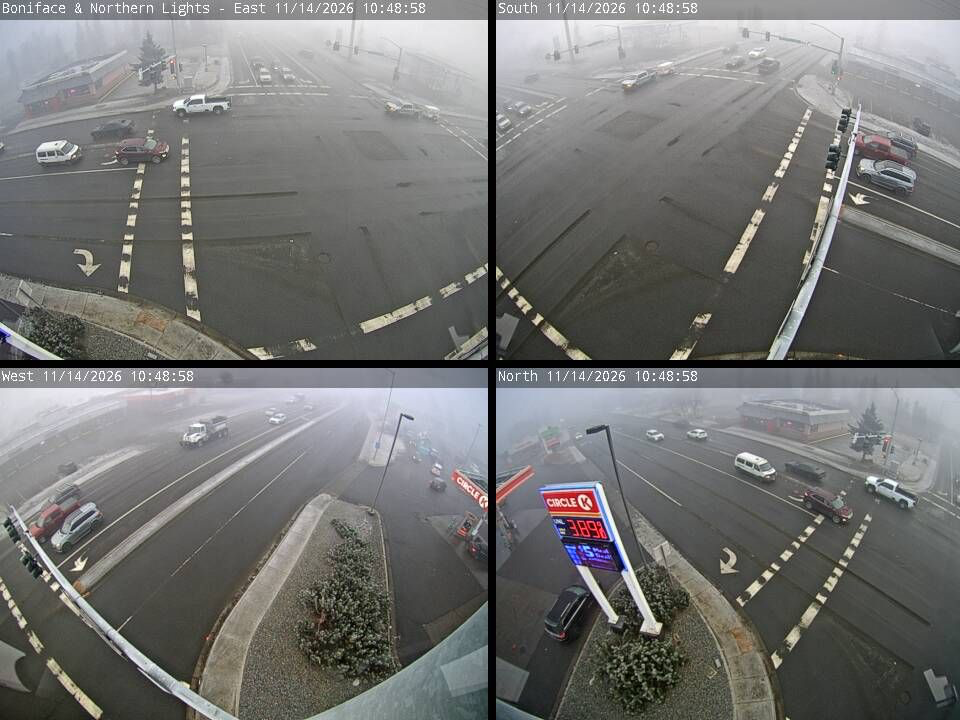
Merrill Field was reporting freezing fog, 22°F and visibility of just one-quarter mile at 9:53 a.m. The Dense Fog Advisory expires at 11 a.m., but visibility may not improve everywhere at the same time.
| Time of Day | Hi Temperatures (°F) | Lo Temperatures (°F) | Driving Tips | Road Risk Level |
|---|---|---|---|---|
| Morning | — | — | Freezing fog and visibility down to one-quarter mile. Slow down, use low-beam headlights and increase following distance. | High |
| Afternoon | 29°F | — | Mostly cloudy. Watch for lingering fog and changing visibility. | Moderate |
| Evening | — | 20°F | Snow expected after 9 p.m., with around 1 inch possible overnight. | Moderate |
Sunday warning: Anchorage has a Winter Weather Advisory from 10 p.m. Saturday through 10 p.m. Sunday. The forecast calls for 3–9 inches of snow and a possible light glaze of ice, with the highest snow amounts expected in South Anchorage and the Hillside. Travel could become very difficult.
🛻✨ Parks Highway: Wasilla to Talkeetna
Wasilla sunrise 9:04 a.m. | Sunset 4:19 p.m. | 7 hr 15 min daylight
| Time of Day | Hi Temperatures (°F) | Lo Temperatures (°F) | Driving Tips | Road Risk Level |
|---|---|---|---|---|
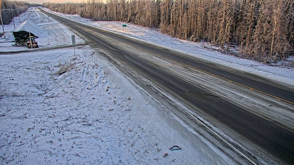
| Morning | — | — | Freezing fog in Wasilla; visibility at one-quarter mile at 9:56 a.m. | High |
| Afternoon | 30°F Wasilla; 28°F Talkeetna | — | Mostly cloudy. Watch for lingering fog and changing visibility. | Moderate |
| Evening | — | 22°F Wasilla; 21°F Talkeetna | Snow expected after 9 p.m. near Wasilla and after midnight near Talkeetna. | Moderate |
💅 Memaw’s road note: The fog advisory includes the Central and Southern Susitna Valley. Talkeetna Airport had 10-mile visibility at 9:53 a.m., but that does not guarantee the same conditions along the highway. Snow is expected tonight.
🚘✨ Glenn Highway: Anchorage to Palmer
Anchorage sunrise 9:03 a.m. | Sunset 4:23 p.m. | 7 hr 20 min daylight
| Time of Day | Hi Temperatures (°F) | Lo Temperatures (°F) | Driving Tips | Road Risk Level |
|---|---|---|---|---|
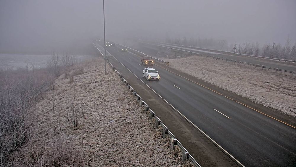
| Morning | — | — | Dense fog around Knik Arm and parts of the Glenn. Anchorage visibility at Merrill Field was one-quarter mile. | High |
| Afternoon | 29°F Anchorage; 30°F Wasilla | — | Mostly cloudy. Keep an eye out for fog pockets and reduced visibility. | Moderate |
| Evening | — | 20°F Anchorage; 22°F Wasilla | Snow expected after 9 p.m. in Anchorage and Wasilla. | Moderate |
💅 Memaw’s road note: The fog advisory expires at 11 a.m., but the winter weather concern is just getting started. Anchorage and Eagle River have a Winter Weather Advisory beginning at 10 p.m. tonight.
🚚✨ Seward Highway: Anchorage to Seward
Seward sunrise 8:54 a.m. | Sunset 4:29 p.m. | 7 hr 34 min daylight
| Time of Day | Hi Temperatures (°F) | Lo Temperatures (°F) | Driving Tips | Road Risk Level |
|---|---|---|---|---|
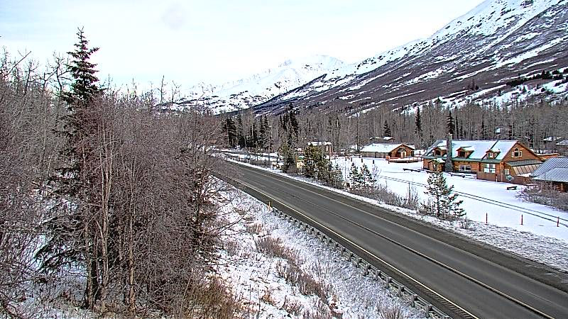
| Morning | — | — | Seward was reporting 35°F at 9:53 a.m. Winds are forecast to strengthen. | Moderate |
| Afternoon | 35°F | — | North winds 20–25 mph, gusting as high as 40 mph. Keep both hands on the wheel. | High |
| Evening | — | 31°F | Snow expected after 9 p.m. Winds 25–30 mph, gusting to 40 mph. | High |
Winter Weather Advisory: 10 p.m. Saturday through 5 p.m. Sunday for Seward. The NWS forecasts 2–4 inches of snow, a possible light glaze of ice and wind gusts as high as 35 mph in the advisory area. The Seward Airport point forecast separately lists gusts up to 40 mph. Snow is expected to change to rain Sunday night, with a brief period of freezing rain possible before temperatures rise above freezing.
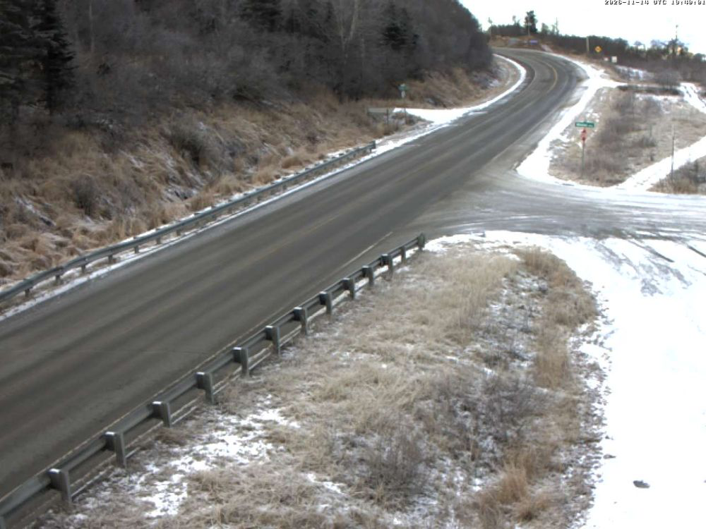
🏎️✨ Sterling Highway: Kenai to Homer
Kenai sunrise 9:04 a.m. | Sunset 4:33 p.m. | 7 hr 29 min daylight. Homer sunrise 9:00 a.m. | Sunset 4:40 p.m. | 7 hr 40 min daylight.
| Time of Day | Hi Temperatures (°F) | Lo Temperatures (°F) | Driving Tips | Road Risk Level |
|---|---|---|---|---|
| Morning | — | — | Kenai and Homer are mostly clear of the dense fog advisory area. Conditions can still vary along the route. | Lower |
| Afternoon | 32°F Kenai; 31°F Homer | — | Mostly cloudy near Kenai, partly sunny near Homer. Watch for changing conditions. | Moderate |
| Evening | — | 23°F Kenai; 24°F Homer | Snow chances increase overnight, especially toward Kenai after 3 a.m. | Moderate |
Winter Weather Advisory ahead:
- Northwest Kenai Peninsula: 3 a.m. Su nday through 7 a.m. Monday. Forecast 3–7 inches of snow and a possible light glaze of ice. The Monday morning commute could be affected.
- Southwest Kenai Peninsula and Southern Kachemak Bay: 6 a.m. Sunday through 10 a.m. Monday. Forecast 4–8 inches of snow and a possible light glaze. The highest snow amounts are expected near the Homer Bluffs. The best chance for freezing rain is along the Sterling Highway near Ninilchik and Anchor Point.
💅 Memaw says: This is shaping up to be a messy one, honey. Snow, freezing rain and a possible glaze of ice are all in the forecast. Give yourself extra time and think twice before heading out if you don’t need to.
🛻✨ Knik Goose Bay Road and Fairview Loop
Using Knik sunrise 9:04 a.m. | Sunset 4:21 p.m. | 7 hr 17 min daylight.
| Time of Day | Hi Temperatures (°F) | Lo Temperatures (°F) | Driving Tips | Road Risk Level |
|---|---|---|---|---|
| Morning | — | — | Freezing fog reported at Wasilla Airport. Visibility one-quarter mile. | High |
| Afternoon | 30°F | — | Mostly cloudy. Watch for fog pockets and reduced visibility. | Moderate |
| Evening | — | 22°F | Snow expected after 9 p.m., with less than half an inch possible overnight. | Moderate |
💅 Memaw’s reminder: That freezing fog can leave a sneaky little mess on the pavement. Take it easy, give yourself some extra stopping room, and don’t let a hurry turn your Saturday into a bumper-to-bumper reunion! 🚗💨
🌌 Aurora Borealis: Quiet Skies
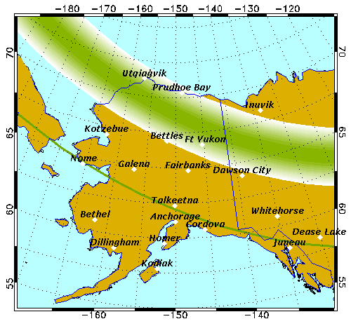
The University of Alaska Fairbanks Geophysical Institute is forecasting quiet aurora activity Saturday night into early Sunday.
Saturday’s Kp index ranges from 1 to 2, with the current reading at Kp 2. Sunday’s early-morning forecast remains at Kp 1.
If skies are clear, quiet aurora displays may be visible directly overhead from Utqiaġvik to Fort Yukon. Farther south, including Fairbanks, Unalakleet, Talkeetna and Tok, displays may be limited to the northern horizon.
Moon phase: Waxing crescent 🌙
☀️ Daylight Check
| Location | Sunrise | Sunset | Daylight |
|---|---|---|---|
| Wasilla | 9:04 a.m. | 4:19 p.m. | 7 hr 15 min |
| Anchorage | 9:03 a.m. | 4:23 p.m. | 7 hr 20 min |
| Seward | 8:54 a.m. | 4:29 p.m. | 7 hr 34 min |
| Kenai | 9:04 a.m. | 4:33 p.m. | 7 hr 29 min |
| Homer | 9:00 a.m. | 4:40 p.m. | 7 hr 40 min |
💅 Memaw’s Parting Words
Sugar, here’s the deal: this morning’s fog is no small inconvenience. One-quarter-mile visibility means you may not see the vehicle ahead until you’re much closer than you want to be. And tonight, snow starts moving into the picture.
Give yourself extra time. Slow down. Use your headlights so people can see you. Leave room between you and the vehicle ahead, and don’t use cruise control when roads are slick.
And if Sunday or Monday travel is on your calendar, keep checking the forecast. Snow totals and the possibility of freezing rain could make the next commute a whole different story.
Memaw wants everybody home safe. No shortcuts, no tailgating, and no pretending your four-wheel drive makes you invincible. Drive alive from dawn to night, hon. 💖
Forecasts from NOAA, the National Weather Service, TimeandDate.com and Alaska 511. Reality checks from Memaw. Both are subject to change without notice.
💅✨
Alaska Headline Living ©️ | Stay informed. Stay inspired. Stay curious.
What do you feel about this post?

Like

Love

Happy

Haha

Sad