Did You Feel It?
A 5.6 magnitude quake near the Kenai Peninsula rattled Southcentral Alaska Thursday morning, a reminder that the nation’s most seismically active state is always teaching preparedness.
By Gina Hill | Alaska Headline Living | October 2025
October 30, 2025 | Anchorage, Alaska
A magnitude 5.6 earthquake struck beneath the southern Kenai Peninsula Thursday morning, briefly rattling Southcentral Alaska and prompting fresh talk about readiness in the nation’s most earthquake-prone state.
According to the U.S. Geological Survey (USGS), the quake occurred at 9:33 a.m. AKDT, about 44 miles south of Seward and 13.5 miles deep. The Alaska Earthquake Center registered light shaking across the Kenai Peninsula and Anchorage, though there were no reports of significant damage or injury.
The National Tsunami Warning Center confirmed that no tsunami warning, advisory, or watch was issued for coastal areas. Within minutes, the USGS and Alaska Earthquake Center posted detailed event data, including intensity maps and shake reports from residents who felt the motion as far north as Wasilla.
“This is a typical moderate event for Alaska,” said an Alaska Earthquake Center seismologist in a morning update. “It’s a reminder that we live in an active region and preparedness is part of daily life here.”
Where It Happened and What It Means
The quake’s epicenter was located near Fox River, Alaska, at the southeastern edge of the Kenai Peninsula, a region laced with deep tectonic faults that absorb and release pressure between the Pacific and North American plates.
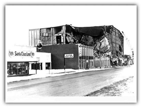
While Thursday’s quake caused minimal disturbance, experts note it fits a long-term pattern: Alaska experiences thousands of small to moderate earthquakes every year, with major historical events such as the 1964 Good Friday Earthquake (magnitude 9.2) still shaping infrastructure and awareness decades later.
🧑🏻💻 Data and Preparedness Resources
For residents, officials recommend reviewing emergency kits and verifying family communication plans.
- Alaska Division of Homeland Security & Emergency Management offers guidance on earthquake safety and response at ready.alaska.gov/Earthquake.
- Real-time and historical data are available from the Alaska Earthquake Center(earthquake.alaska.edu/earthquakes/recent_list) and the USGS Earthquake Hazards Program(earthquake.usgs.gov/earthquakes/map).
- Detailed event data for this specific quake — M 5.6 – 47 km SE of Fox River, Alaska — can be found on the USGS event page: earthquake.usgs.gov/earthquakes/eventpage/ak025dxe5mlz.
These resources include shake maps, intensity summaries, and aftershock forecasts for emergency managers, educators, and residents.
🧠 Preparedness Is a State of Mind
While Thursday’s earthquake will likely fade quickly from the headlines, experts emphasize that each tremor offers an opportunity to check supplies, secure homes, and revisit safety plans.
As one Anchorage emergency-management official put it, “Every shake is a free drill and Alaska gives us plenty of them.”